|
|
|||||
|
|
Climbs by: |
Last Updated 08/13/05 |
|||
|
At 12,009 feet, Hyndman Peak is the highest pile of rubble in the Pioneer mountain range of central Idaho. Well worth doing (once). |
|||||||||||||
|
|
||||||||||||||
|
Trip Report |
||||||||||||||
|
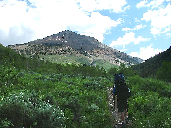
Scott and I reached the trail head and began our approach around 9:30am. The weather report called for thunder storms, but in traditional summer time fashion, there were no signs of the impending weather patterns.
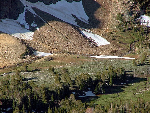
The colors on the approach, and throughout the weekend, were a welcome surprise. Of all the trip reports I Googled in the days before our trip, most included photos that could have been transmitted from either one of the Mars rovers.
|
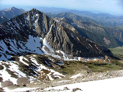
 Our first sight of Hyndman from around the West shoulder of Cobb.
|
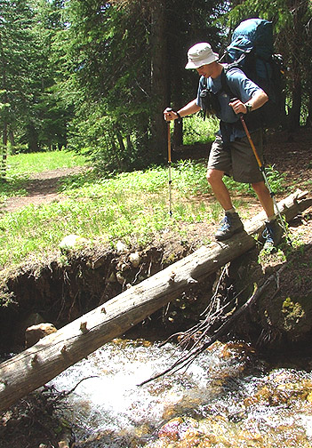 Another funny thing about the Googled reports. It seems everyone misses the trail on their first time out. Lucky for me, Scott had already paid his Hyndman Virgin dues and missed the trail when hiking with Alyson a few weeks earlier. Seems I got off "Scott free". So here's the secret: Just after the trail disappears at the Yurt, cross the creek and look for a well beaten path leading up the center of the steep grassy hill.
|
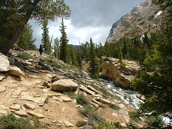 Even if there were no 12' mountains around the scenery would still be well worth the hike. But we couldn't help but notice that the sky had lost a touch of blue.
|
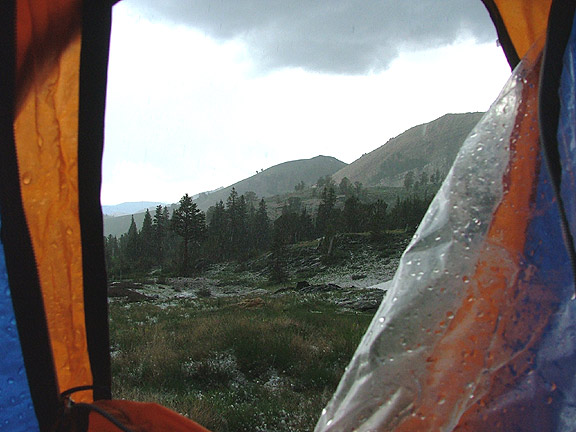 By the time we reached the Hyndman Basin, a full fledged thunder boomer had rolled over the range and began pelting us with icy rocks. We raced to the nearest almost-flat spot and flung the tent out like a one-man fish net, snapped just enough clips on poles to keep the structure in place long enough to fling the rain fly over the whole works (yes Travis, I remembered the tent poles this time), then threw our packs in and zipped ourselves out of the storm. We couldn't stop laughing as we tried to hold the tent together from the inside while the wind argued from every direction. After attaching the remainder of the tent from within the shelter of the rain fly, we napped for a bit and waited for the storm to pass. Once it looked like it might clear, we decided to see how far up Hyndman we could get, after all, it was still early afternoon. As it turned out, we didn't get very far before the threat of another storm sent us back to camp.
|
 Another opportunistic nap, and another break in the weather found us half way up Cobb. The west ridge is a spectacular climb (as much of it as we did that is), one we'll surely come back to finish. But on this day, the roaming thunder storms were making us a bit gun shy and we agreed that watching that light show from the front row wasn't such a good idea. We watched as a storm to our south and another to the west played a thunder head version of paper scissors rocks, to see which one would swoop in and drench us. So once again, we headed back to camp.
|
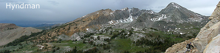
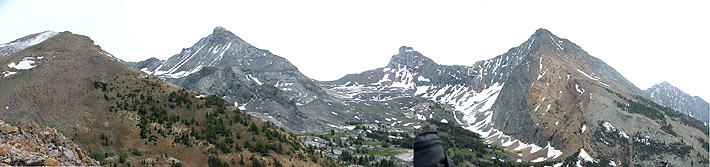 But the storms turned away and we still had a few hours of sun light, so we headed west to explore a baby summit at the end of Duncan Ridge. From here you can see Cobb on the right, Old Hyndman in the middle and Hyndman on the (distant) left. They are all actually a lot closer than they look in this panorama. It's a good thing too because, of course, while we were there, it started to rain. Again.
|
 We were up before the sun to try to get some in climbing before the storm cycle repeated itself. From the saddle between Hyndman and Old Hyndman you get some spectacular views of Hyndman Basin to the south, and the Wildhorse Creek drainage to the north.
|
 Our route would follow (roughly) the crest of the range to it's high point.
|
 Next time you read a route description that says "it's a simple rock scramble", just keep in mind that a broken bone on the side of a slope like this is a problem far from simple. Although the route is not difficult, there's ample potential for your day to go very bad. Take your time, watch your step and be ready to dance. Imagine guys with red plaid shirts and suspenders running top speed on a telephone pole floating in a pond at your last western style logging show. Keep that thought in mind and stay light on your toes as you pick your way long this endless pile of rocks.
|
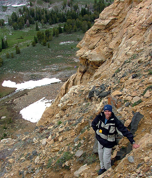
 See any loose rocks Scott?
|
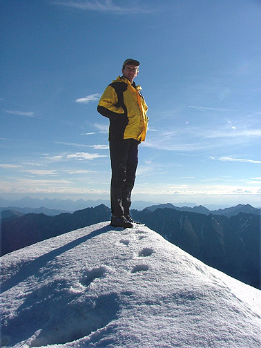 Finally, at the summit we found some solid footing.
|
 The view from the top is worth it though.
|
 See our tent?
|
 How 'bout now?
|
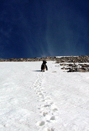 We cheated the rocks for a few hundred feet on our way down by taking a snow finger that reached from the summit, nearly to the valley floor. But when it got too steep to down climb without tools, we rejoined our Precambrian rivals for a final traverse back to the saddle, and on to our camp. A non-stop hike back to the car (which seemed to be a mile or two longer than it was on our way up), and our weekend in the Pioneers was brought to a successful end. |