Mt. Moran
Teton Range WY
15-June-2013
With Steve Durnal
View MoranDay1 in a larger map
Day 0
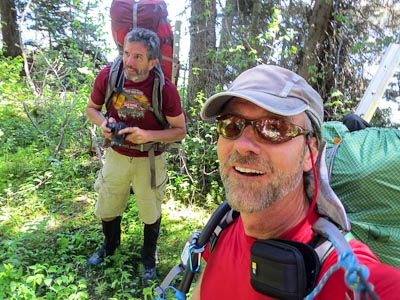
Steve Durnal and I headed east to Jackson Wyoming with bags of climbing gear filling the back of The Planet, and Lester’s canoe on the roof.
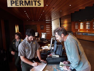
Our first stop was the Jenny Lake ranger station where we picked up our bear bucket to store our food, our back country permit and info on the route and advice on the best way to cross Jackson Lake. As it turned out, the ranger had heard of nobody heading up the Skillet lately so instead of getting beta from him, he was glad we would be providing him with beta on our return.
Our second stop was at the Moose visitors center where we got a permit for the something or other, our third stop was at a Cheveron just outside of the Moose park entrance where we picked up a state license for the canoe.
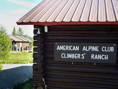
Then it was off to the American Alpine Club Climbers Ranch. The ranch is a group of about nine little cabins, each with about six bunks available for $16 a night for members and $25 a night for non-members.
We stayed in Cabin #6 with four others... well almost four others. The cabin was divided into two rooms. The back room had two bunks where two administrators stayed, and four bunks in the front room, where Steve and I stayed. There too was a climber named Andy who had flown out from Boston to climb the Grand Teton with the Exum guides. The fourth climber in our cabin had a sewing machine and a bunch of rip-stop nylon and webbing spread out all over his bunk, while he slept in his van. We never did see him in the cabin, but we’re pretty sure we parked by him at one point. Andy said he was an “interesting” guy, but wouldn’t elaborate.
The camp had just finished up their “work week” in which members can come out and help perform maintains on the camp, building picnic tables, maintaining trails etc. In return for a week of work, members may stay at the camp for the entire month of June for free. That’s the deal our unnamed fourth bunk mate was taking.
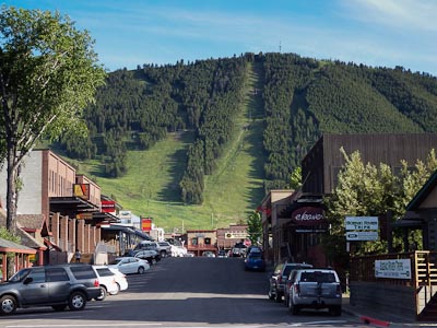
Finally, we had all our ducks in a row, and headed into Jackson for one last real meal before heading off to the wilderness. Snow King, in the background, is one of the several awesome ski areas in the Jackson Hole valley.
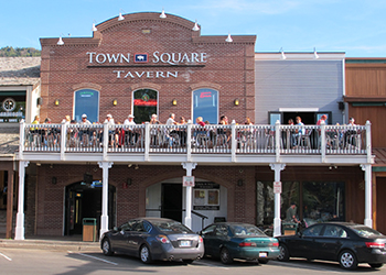
We were looking for spaghetti, but settled for a huge plate of Pasta Primavera at the Town Square Tavern. I highly recommend this meal it was delicious… just don’t start on the balcony and try moving to a table inside. They get all messed up for some reason.
We returned to our cabin well after dark struck up a conversation with Andy that went just a little too long, as the guys in the back room gave us a shout that we were being too loud. Oops!
Day 1
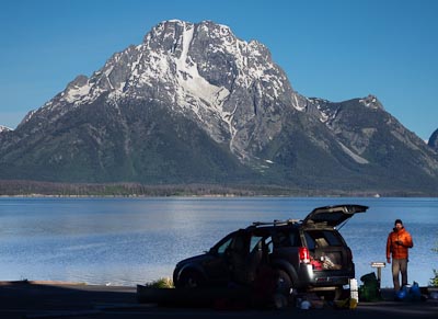
We were up and out at first light, and headed over to Signal Mountain Campground where we were to begin our canoe leg of the trip. We would have started out at the usual put-in at Spalding Bay, but as the ranger had explained the day before, that area was closed due to the government “sequester”.
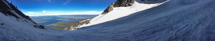
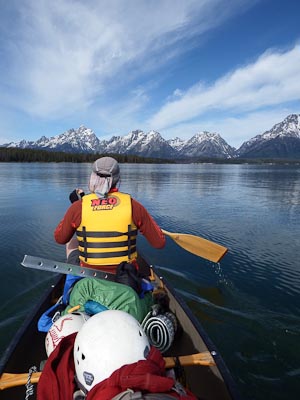
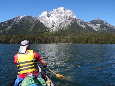
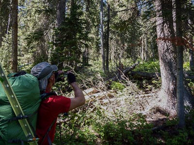
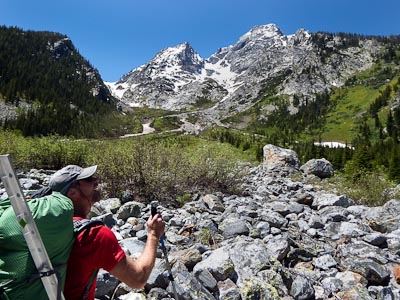
You can see our entire route in this shot. We cross the trees at their narrowest part, follow the slide/snow fingers up to the pan of the Skillet Glacier, then continue up the narrow handle of the pan that shoots up and slightly to the right all the way to the summit ridge..
Spoiler alert! We turned around about half way up the handle.
The sequester closure would add a couple of miles of paddling, including a crossing of Spalding Bay. We wanted to stay close to the shore in case of trouble, and crossing this bay would be our longest section of open water. But we would have missed this view of the main Teton range.
Seven miles of paddling, and we were finally crossing Bearpaw Bay, with Mt. Moran directly ahead. We had expected more of a beach having seen photos on-line of a very empty lake and a long muddy shore separating the water from the trees, but as it turned out we went ashore on a very narrow beach.
We pulled the canoe up a three foot embankment and slipped it behind the first row of Spruce Fir and Aspen trees.
Looking at our path ahead was a little daunting. There is no maintained trail from the lake to the base of the mountain, instead there’s just a lot of wind fall, brush and rough terrain. We did end up finding an animal trail here and there which made the going a little easier as we got a little higher, but I was glad I had my gaiters on.
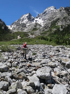
Once we were out of the woods, we were wondering if that was easier than the boulder fields that came next, or the thick shrubs that came after that.
We were told of some major water storms that occurred in the days before our arrival, and there was clear evidence of water coursing over shrubs and boulders that were now dry as a bone.
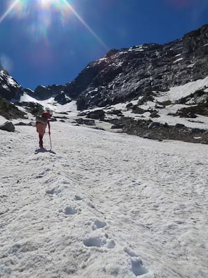
Once on the snow fields, things began to pick up.
It was mid-afternoon and we couldn’t believe how firm the snow was. It was in perfect shape and we were excited that it would only get better as we got higher... Or so we thought.
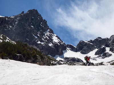
At around 10’000 feet, we reached the lower edge of the Skillet Glacier and prepared a place to spend the night, alongside a huge, fresh slide area. The slide had travelled down the length of the Skillet’s pan area, right up to the lower edge of the pan, ending just behind Steve in this shot. There was little doubt that it had been brought down by the rain storm. The good news was that the rain/freeze cycle was also responsible for the solid snow conditions that we were enjoying.
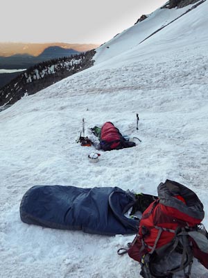
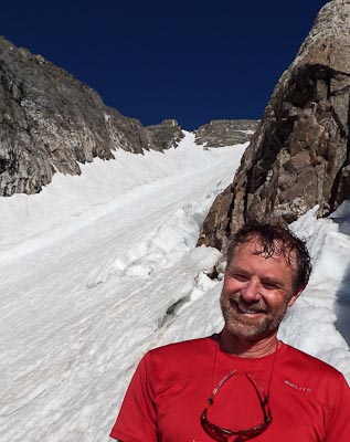
It was still early when the sun dipped behind the mountain. We ate some dinner, fetched a couple bottles of water from a smallish water fall that flowed over a nearby boulder, and climbed into our bivvy sacks for a few hours shut eye.
Although we had clear skies all night, the temperature never dropped much. No frozen water bottles, no stiff boots… made for a nice night’s sleep, but the snow conditions on the mountain were going from good to not so good.
Day 2
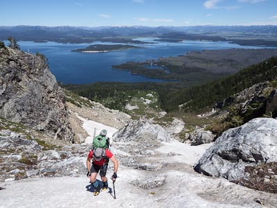
We took the time to make a hot breakfast, and didn’t get started until a little after 4:00, and noticed right away that the snow had softened up considerably.
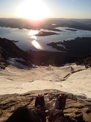
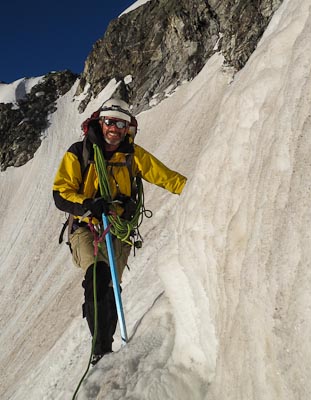
Here, we are reaching the top edge of the Skillet’s pan.
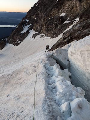
One of the bigger obstacles on the climb is the “glacier splitzen”, a.k.a. Bergschrund. Turned out there was an easy snow ramp running diagonally between two crevasses that made passing this area pretty easy.
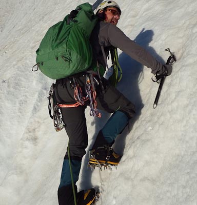
Once above the splitzen, the slope got steeper and the snow got softer. Going up, was easy, but I have to admit I wasn’t looking forward to coming down this.
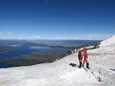
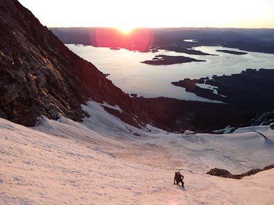
Once the sun was higher in the sky, things were getting warmer, and our pace was getting slower.
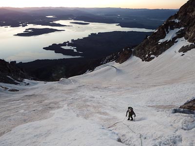
The snow still looks really good in this shot… makes me second guess our next decision a little.
By the time we got about half way up the handle, we were down to tee shirts and sweating like pigs. We decided to turn back at this point. We only had about a thousand feet to climb (that’s the summit ridge in the upper left of the photo), but our pace was really slowing down. We calculated how long it would take to summit, guessed about how soft the snow would be on our descent, and the fact that we still had to paddle across the lake before dark, and it wasn’t too hard to see that we were out of time.
The snow wasn’t holding our weight without toeing in, so I set up a body belay as Steve stepped back out onto the snow field. He only went a couple of steps before the surface snow gave way under his feet and he slid about six feet before being caught by the rope.
From that point on, we used ice axe belays and a leap-frog approach to our descent. At one point, I thought to myself how ridiculous that seemed and turned around to do more of a plunge-step descent, but suddenly found myself sliding down the face. Although I quickly rolled into a self-arrest position, it was ineffective and I didn’t stop until I felt the rope tighten up after about 25 feet of sliding.
On top of the yucky snow conditions, Steve’s crampons were balling up severely making even the easiest slopes a challenge. A long glissade would have been much easier, but neither of us felt like getting soaked.
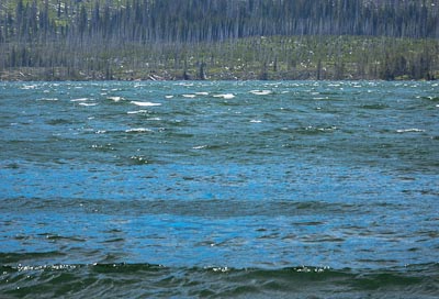
Once back to the boulder fields, we made pretty quick time getting back to the lake. Just as we launched the canoe, a smallish storm drifted over from the west and began to kick up some pretty big waves. We made it across Bearpaw bay, but as soon as we rounded the corner things started to get very interesting.
At first the waves were coming from the side, which wasn’t all that bad since I could see when the largest waves were approaching and could turn into them. But after a few hundred yards, and another small corner, the waves were coming from behind and the canoe began surfing the waves, first going forward as the wave lifted the back of the canoe, then the boat would slip backwards as the wave moved forward and lifted the front.
We didn’t feel like ending our trip with a cold swim, so we beached and began to shelter our gear from what looked like a massive rain storm approaching.
An hour or so later, things were calming down, and we decided to give it another go. The lake continued to relax and we made it back to the car just after the sun set, landing amidts a small group of photographers trying to avoid capturing our canoe in their sunset shots.